Angola
The Lisima Foundation works in the highlands of Moxico Province, a region known as Lisima lya Mwono (“Source of Life”), which forms the headwaters of the Okavango, Zambezi, and Congo river systems.
Our work focuses on protecting the Angolan Highlands Water Tower through ecological research, sustainable land-use planning, and community-led conservation initiatives.
Through Projecto Lisima, we support local communities to develop sustainable livelihoods such as regenerative agriculture, beekeeping, and natural resource management, ensuring that conservation and development work together.
We collaborate with government partners and scientific institutions to better understand this critical water source region and its role in sustaining ecosystems across Southern Africa.
This work helps secure the headwaters that underpin the long-term health of the Okavango Basin and beyond.

the water tower of southern africa
An estimated 2.5 trillion gallons of water flow through the Okavango Basin each year, supporting over a million people and sustaining one of the world’s most important inland wetland systems.
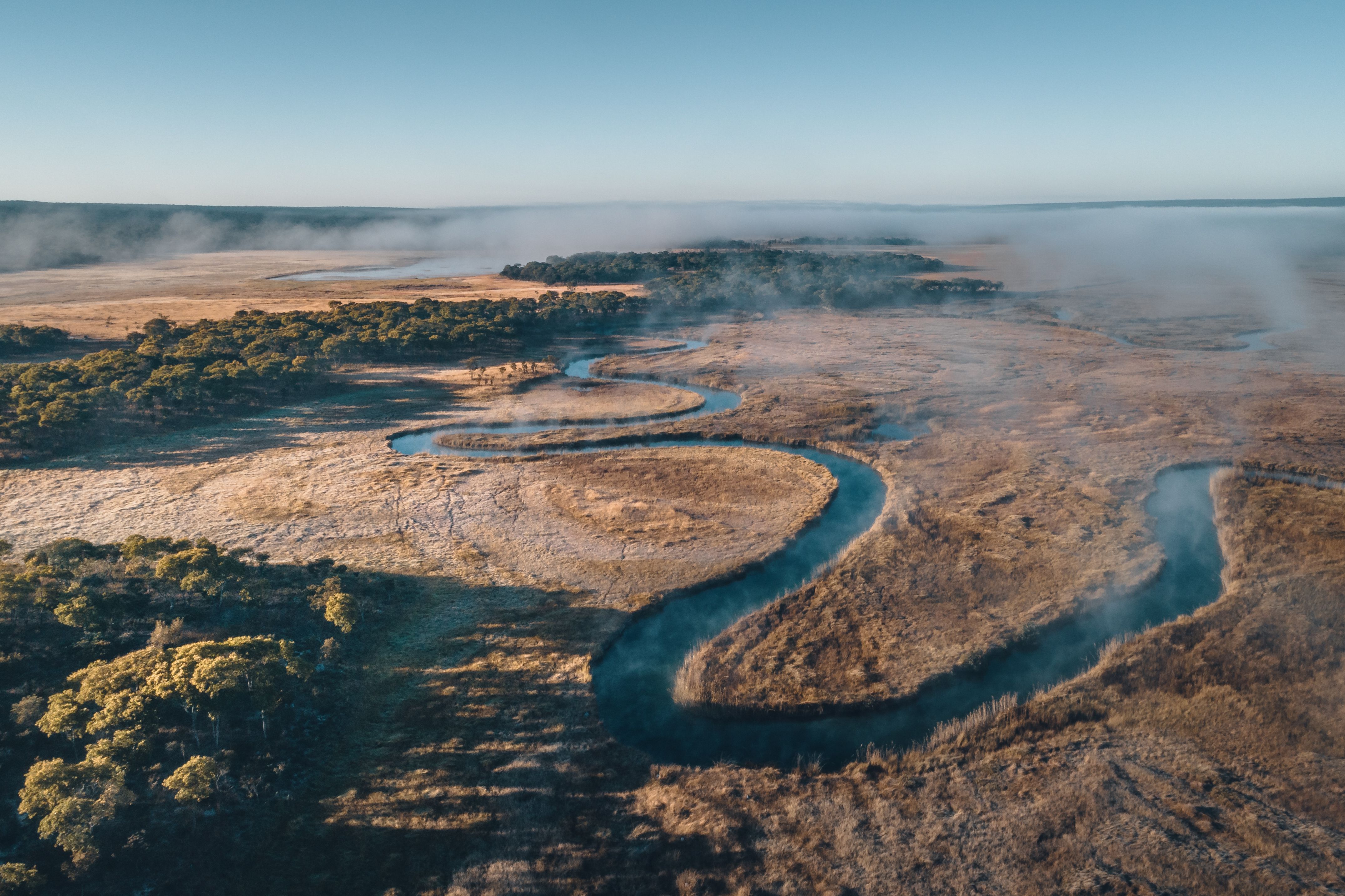
The Angolan Highlands Water Tower, located in southeastern Angola, is the primary source of this system. More than 95% of the water that reaches the Okavango Delta originates here, falling as rain across a vast landscape of lakes, peatlands, rivers, and miombo woodlands.
This region has recently been recognised as a Wetland of International Importance under the Ramsar Convention, highlighting its global significance for biodiversity, water security, and climate resilience.
Major rivers including the Cuito, Cuanavale, Cuando, and Lungue-Bungo transport water southwards, feeding a complex network of wetlands and floodplains that regulate the entire Okavango system.
Protecting this water tower is therefore critical not only for Angola, but for the long-term health of the Okavango, Kwando, and Zambezi river systems.
Watch the video: Introducing the Angolan Highlands Water Tower, narrated by Dr Steve Boyes here
The health of this crucial source of water for wildlife and people depends on a system of lakes and rivers that originate in Angola—waters that currently have no formal protection.
- Dr Steve Boyes


We are expanding our research to better understand the role of the Angolan Highlands Water Tower, not only in sustaining the Okavango Delta but also in supporting the wider Zambezi Basin. This work contributes to a broader understanding of Southern Africa’s interconnected water towers and their importance in a changing climate.
Importance of our work
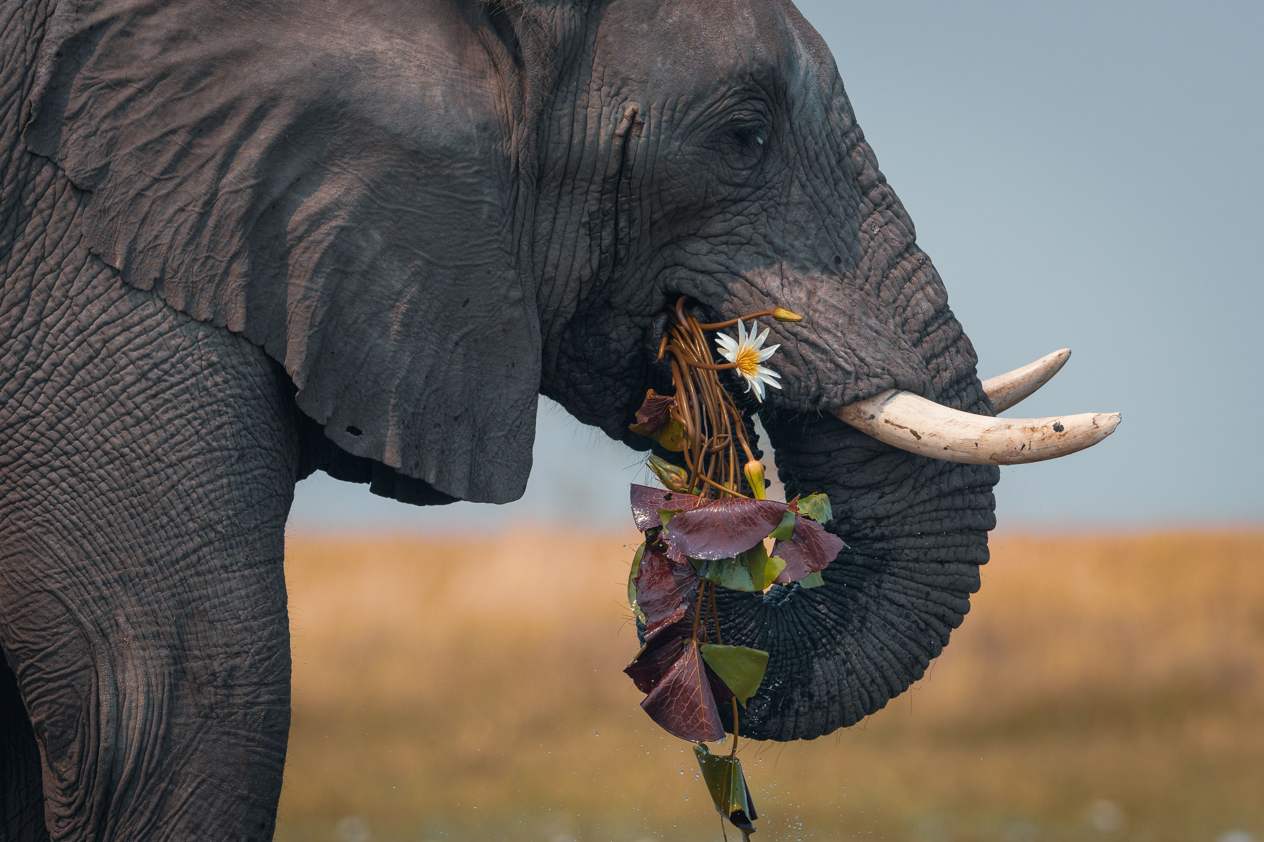
From elephants to termites, every species plays a role in maintaining the health of the Okavango Basin. Protecting biodiversity at its source in Angola’s highlands is essential to sustaining ecosystems across the entire region.
BIODIVERSITY
The Okavango Basin is one of the most biodiverse regions in Southern Africa. While attention has often focused on the Delta, research in Angola’s highlands continues to reveal equally important and largely unexplored ecosystems upstream.
To date, NGOWP research has documented over 50 species new to science, with many more potentially undiscovered, highlighting how little of this landscape has yet been studied or formally protected.
BIRDS
The basin supports hundreds of bird species, including globally threatened populations. Ongoing surveys continue to expand regional knowledge, including new country records, range extensions, and important breeding populations such as the vulnerable wattled crane.

MAMMALS
Camera trap surveys in Angola’s source lake regions have confirmed the presence of key species including lion, leopard, cheetah, and the critically endangered African wild dog, significantly extending their known ranges.
Evidence also suggests that elephants are returning to these upper catchments. Protecting and restoring these habitats could help reconnect historic migration routes and reduce ecological pressure further downstream in Botswana.
PLANTS & ECOSYSTEMS
Botanical surveys have revealed numerous plant species new to science, alongside extensive peatland systems surrounding the source lakes.
These peatlands function as natural water and carbon stores, regulating river flow, buffering drought, and strengthening ecosystem resilience across the basin.
PEOPLE & COMMUNITIES
The Okavango Basin supports over a million people across Angola, Namibia, and Botswana. In Angola, our work focuses on communities living around the source lakes, where sustainable livelihoods are essential for long-term conservation success.
Through Projecto Lisima, we support community-led initiatives including regenerative agriculture, beekeeping, and natural resource management. Investments in training, solar energy, and social infrastructure help ensure that conservation delivers tangible benefits while strengthening stewardship of the landscape.

our work
Our work explores and protects the extraordinary biodiversity of the Okavango River Basin, safeguarding ecosystems, wildlife, and the communities that depend on them. Your support helps our teams protect threatened species, restore fragile habitats, and empower local communities through rigorous science, independent research, and hands-on conservation action.
Join our flock
Subscribe to our newsletter to receive exciting news about our projects.
We care about the protection of your data. Read our Privacy Policy.